
White Bluffs- North Slope, Eastern Washington


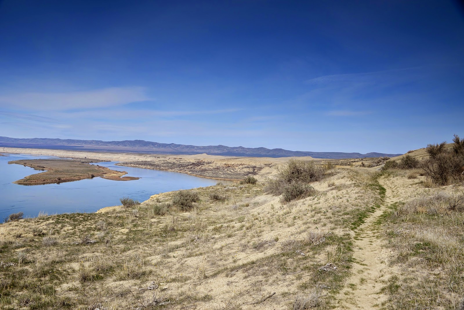
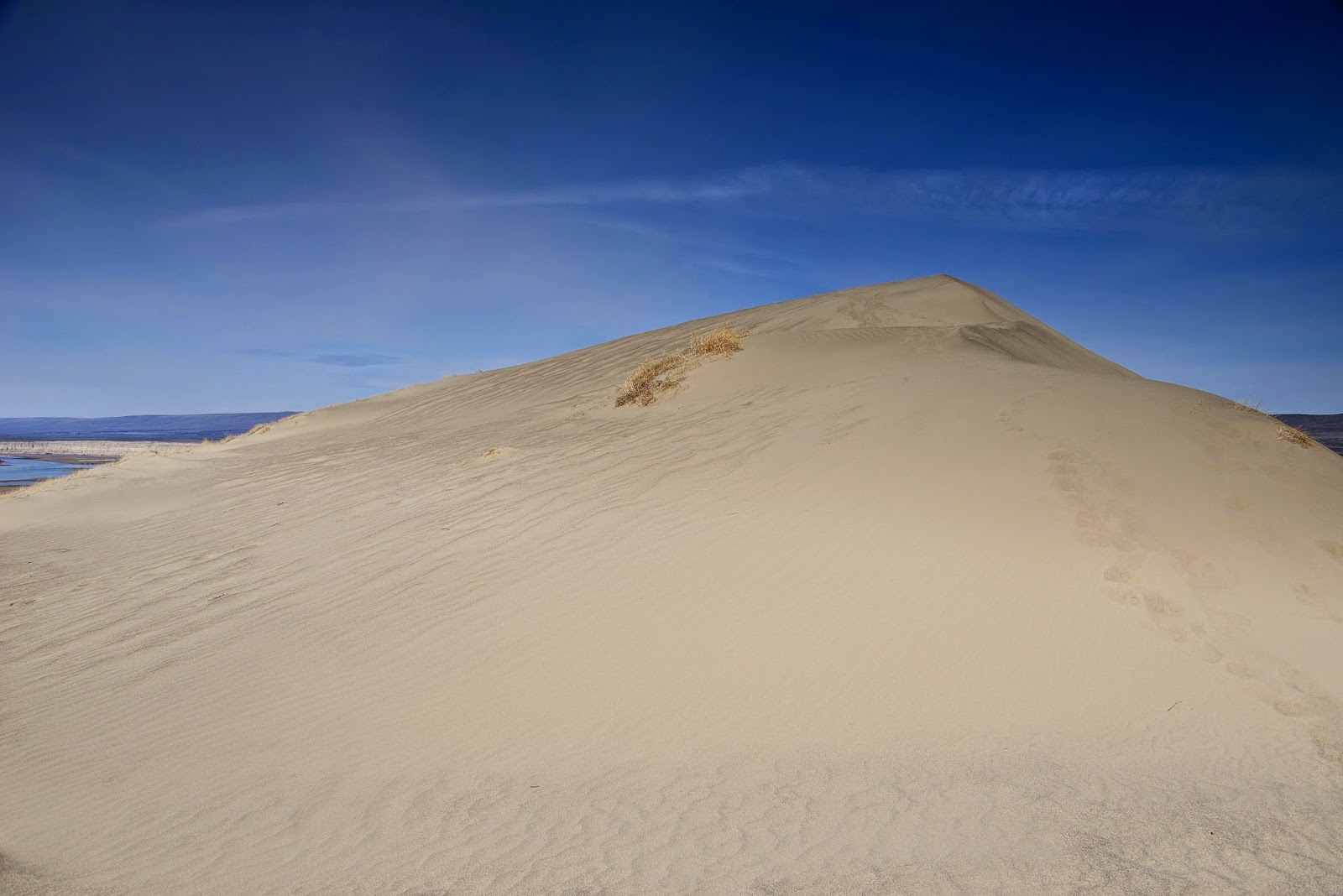
I have wanted to hike the White Bluffs for a while, just haven't set aside the time to get there. So March 22nd my nephew and I headed down towards Mattawa to hike this trail. It is quiet the drive, but the scenery is very fascinating along the way. The White Bluffs area is totally different than any hike I have been on, it is a combination of sage brush, grass, and lots and lots of sand. Gorgeous view of the Columbia River and over onto the Hanford Nuclear Reservation. The trail is fairly easy to find, well marked roads, that lead you to the Wahluke National Wildlife Refuge area. After you leave the gravel road and hit the pavement again that leads to the boat launch area it becomes a little bit confusing on where the trail actually starts, and where to park. It's best to just act like you know what your doing and pull over into the first pull out area on the right and park. The trail starts from that first pull out area and heads up the short hills that get you above the Columbia River. From there it wanders and makes a few bends, then follows the cliffs along the river. The views start as soon as you get above river level. You wander through the sage, low grass, a few flowers, more where on the way, then heads out onto the sand dunes. From there the trail becomes faint and pretty much disappears, so we headed to the high points of the dunes and started heading towards the largest one. Beautiful 360 degrees views of the surrounding landscape, lots of animal tracks, and bugs crossing back and forth arcoss the sand. The only thing missing to make it a perfect day was flip flops, a beach towel and the sound of waves crashing. Lovely weather, hardly any wind, which was nice due to I can imagine the places that the sand could lodge and cause all kinds of pain. It was such a lovely day I had to take plenty of pictures, didn't want to let any granules of sand feel left out. I think this would be a lovely place to hike in the winter, not sure how the roads would be to get there, summer would make it a scorcher with all the exposed landscape. I would defiantly advise a hat and plenty of sun screen, even in March we got a little bit of color. I will post more pictures of the dunes, like I said couldn't let any sand feel left out of the pictures.

Comments

Post a Comment

Popular posts from this blog

North Cascades Hwy 20, Snowshoeing

Since we don't take snowshoeing very serious and it's just another way to get out in the great outdoors and have some fun, we snowshoe highway 20 from the parking area up the pass quiet often.  It is a busy snowmobile area, but if you just be aware of whats going on around you, it is safe.  There is so much room to have fun, snow covered slopes, snowshoe up the road, or venture off the road.  It is a gradual climb up the road, we never get very far before we run out of gas and are ready to head back down.  I would love to some day take a snowmobile to the top of the pass...and snowshoe....I keep dreaming.  This is a easy location to just get out, stretch your legs and enjoy the fresh winter air.  I have always been a little bit apprehensive about  snowshoeing where there is snowmobile activities, but so far we have met only super polite folks and very respectful to keep their distance of folks snowshoeing.

Yellow Jacket Sno-Park.......................

December 29th, 2012 came along with some beautiful weather in the Mazama area....broken blue skys and a nice 21 degrees.....with my little brother and his wife up visiting through the holiday season we ventured out to play in the snow.....We originally headed up to snowshoe the Cedar Creek trail....but Hwy 20 wasn't plowed past the first sign at the bottom.....and when we came across the Early Winters bridge we could see trucks and cars parked on both sides of the road....somewhere between 25-40 rigs.....lots of snowmobile trailers.....we decided that we needed to locate another snowshoeing spot with a little less traffic since my brother wanted to do a little snowboarding if possible......so we headed to Yellow Jacket Sno-Park....Large parking area with just a few vehicles parked....we strapped on our gear and headed up the trail....nice easy hike up a groomed snowmobile track....lots of places to step off the trail and explore...we pretty much stuck to the trail on the way up.....

Enloe Dam-Simiklameen River

While we were up in the area hiking Whistler Canyon Trail, near Oroville we decided to take a side trip and visit the Enloe Dam....WARNING.....The road down to Enloe Dam requires a high clearance vehicle....we did make it in a Chevy Equinox....but I would not recommend it...SCARY....and hard on the nerves....Without good directions and a confusing map we got turned around in Oroville...figured our our location and headed towards the Simiklameen River....Beautiful river....green in color and winds its way through the valley....Enloe Dam Road is well marked with a sign on the right...road on the left...the first section is not terrible....the bottom section I would not do again in anything but a 4x4 rig.... explored the trail that follows the river down past the dam towards the power house.....very nice place to visit...it is really to bad the road is in such terrible shape....I would imagine that it gets its fair share of people that stop and sight see....from there we continued up t...